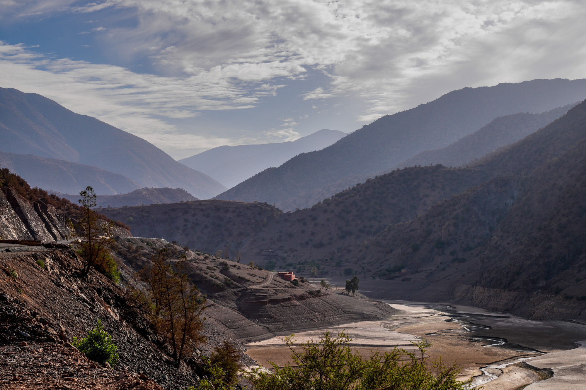
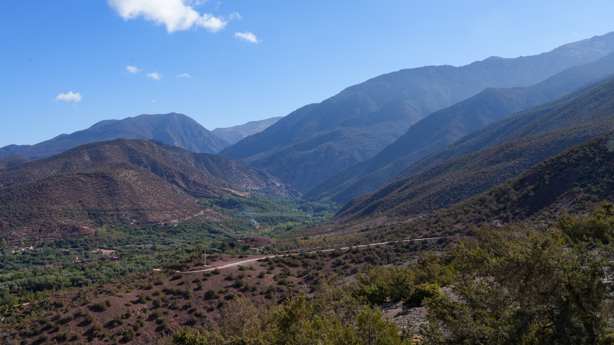
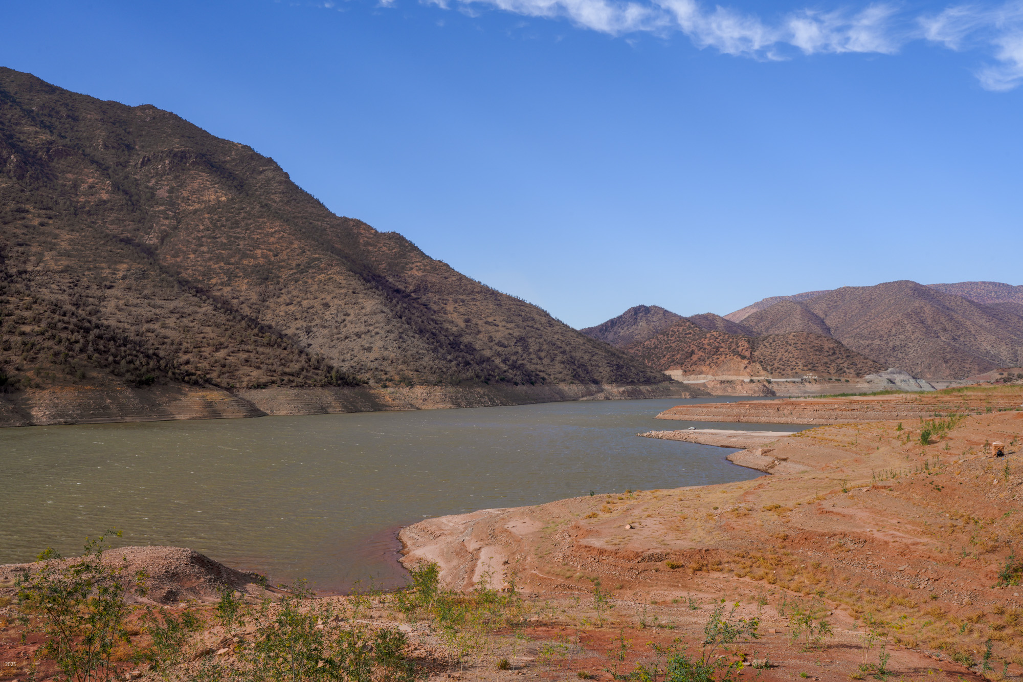
N'fis river valley upstream from Ouirgane
Ouirgane, High Atlas, Morocco
Mon 27th – Fri 31st October 2025
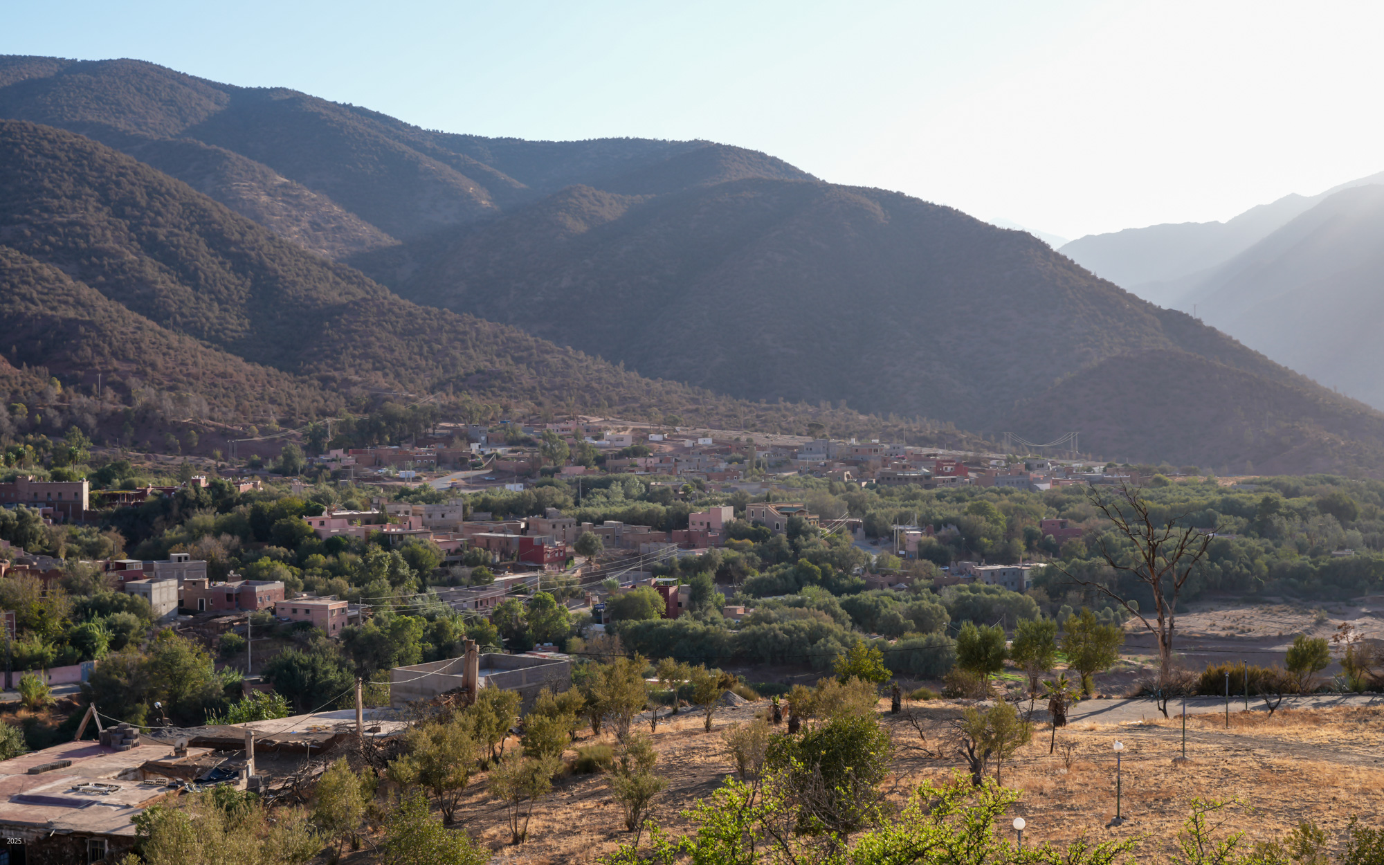
Ouirgane is a peaceful and friendly Berber village situated in a narrow valley in the Western High Atlas mountains. It lies about 40 kilometres northwest of Morocco's highest peak, Jbel Toubkal and just 63 kilometres south of Marrakesh. It offers a cooler climate, and in 2008 the Yacoub el Mansour dam was constructed below the town adding tranquil vistas of the reservoir. It is a very popular retreat for Marrakesh residents during the summer. When we visited in October, we found it very quiet.
A note on pronunciation in Morocco: Ouirgane is pronounced “we’re g Ann”, with the accent on the “we’re”. Until the Arabs arrived in the seventh century, the most common language in Morocco was Latin. In 1912, Morocco became a French protectorate. Morocco became independent in 1956. Moroccan names were transcribed in the Latin and French alphabets which have no “w’, so “ou” was used to represent the “w” sound.
Getting to Ouirgane
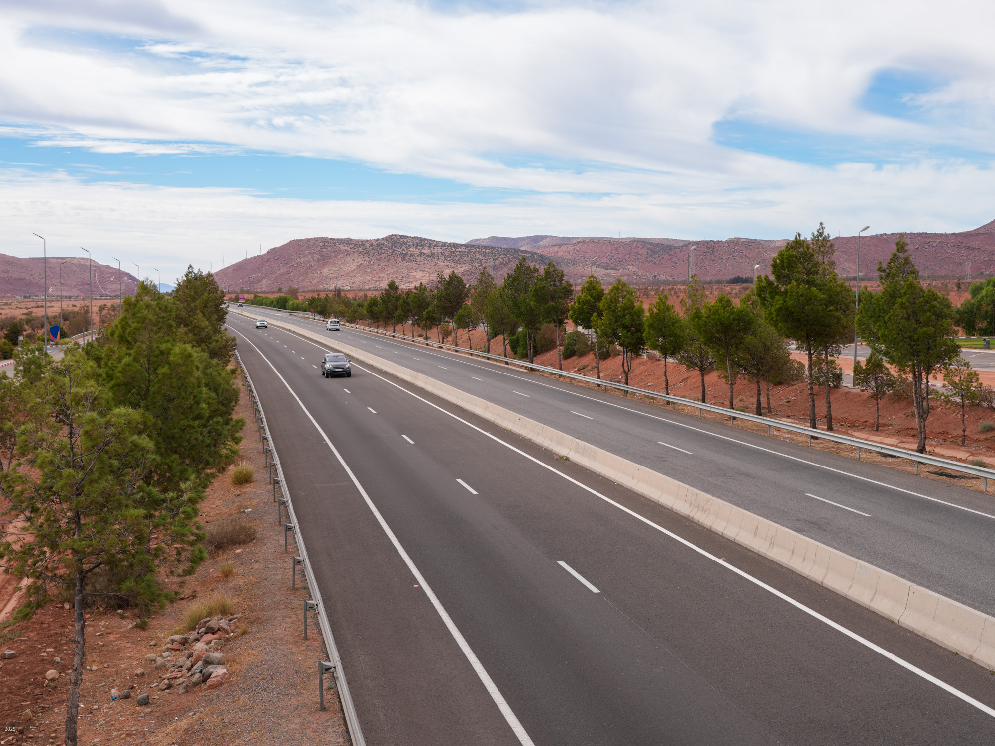
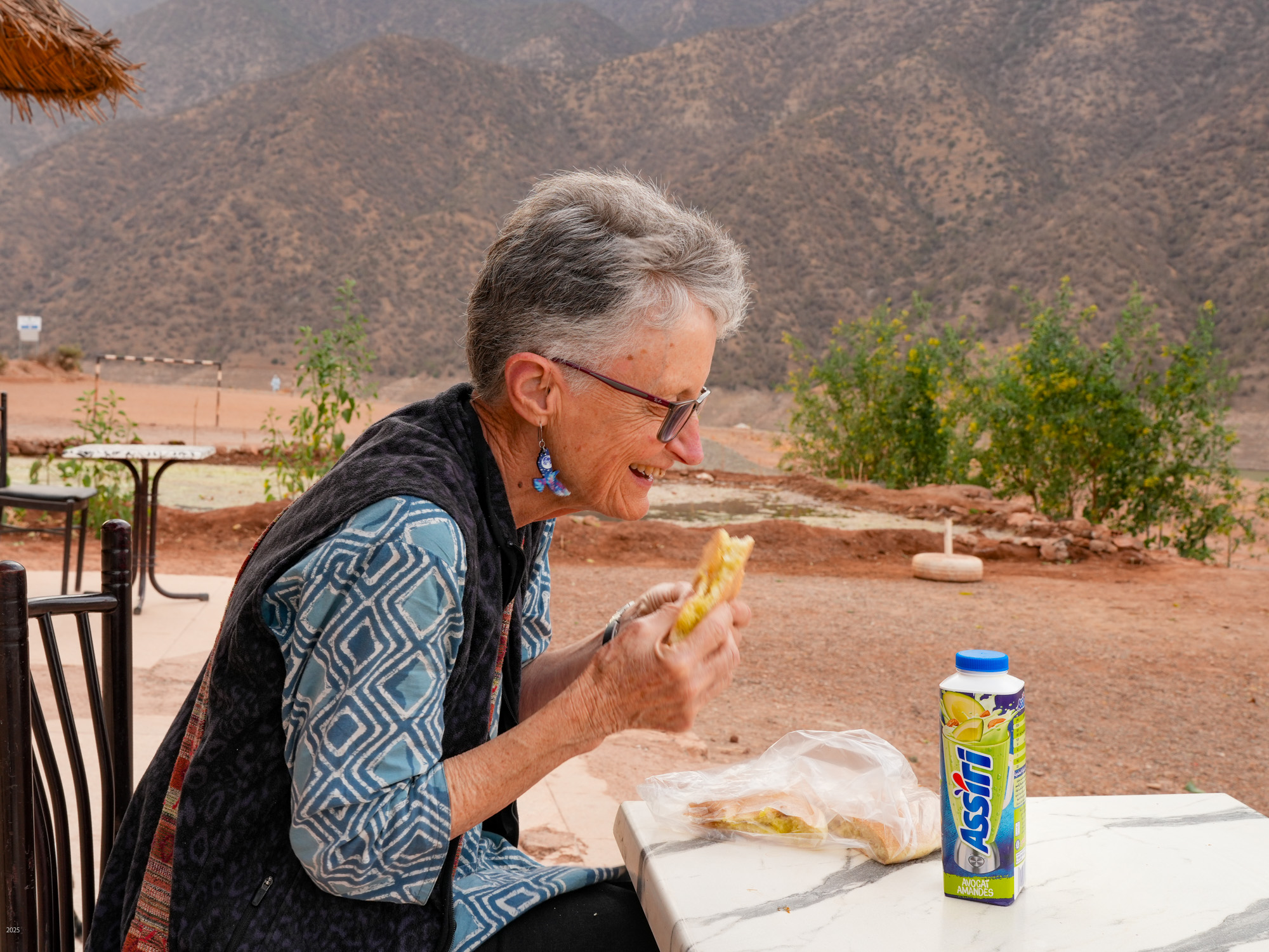
We departed from Sidi R'bat on the Atlantic coast in a taxi at 10 am. After driving almost to Agadir, we got onto the A3 Agadir – Casablanca Autoroute. This expressway is built to high standards. As it winds northeast through arid valleys, the speed limits are mostly 100 or 120 km/h, dropping to 80 and 60 km/h in places. Traffic was light and drivers stayed at or below the speed limits. The rash, aggressive driving that characterises India's expressways was absent as were the numerous vehicles. After a couple of hours, we stopped at the Imintanoute service area. Soon thereafter, we turned east onto a regional highway R212. We stopped at M'Zouda for lunch of tagine. After skirting the barren High Atlas for some time, we turned south and headed over a low pass into the Ouirgane valley. We reached the Riad Idar guest house at about 4 pm, to relax over a cup of tea with a refreshing view of olive trees and mountains from our room.

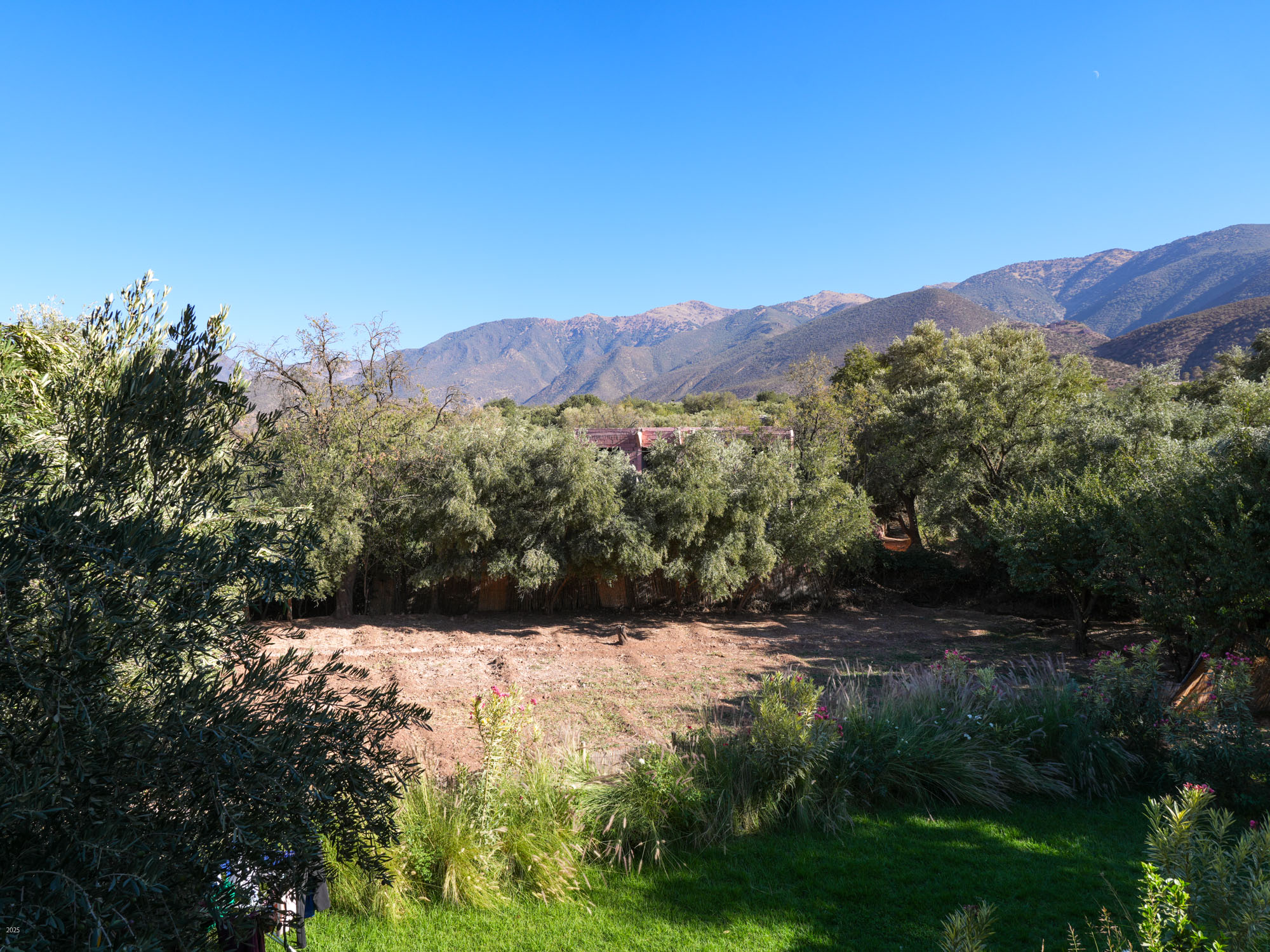
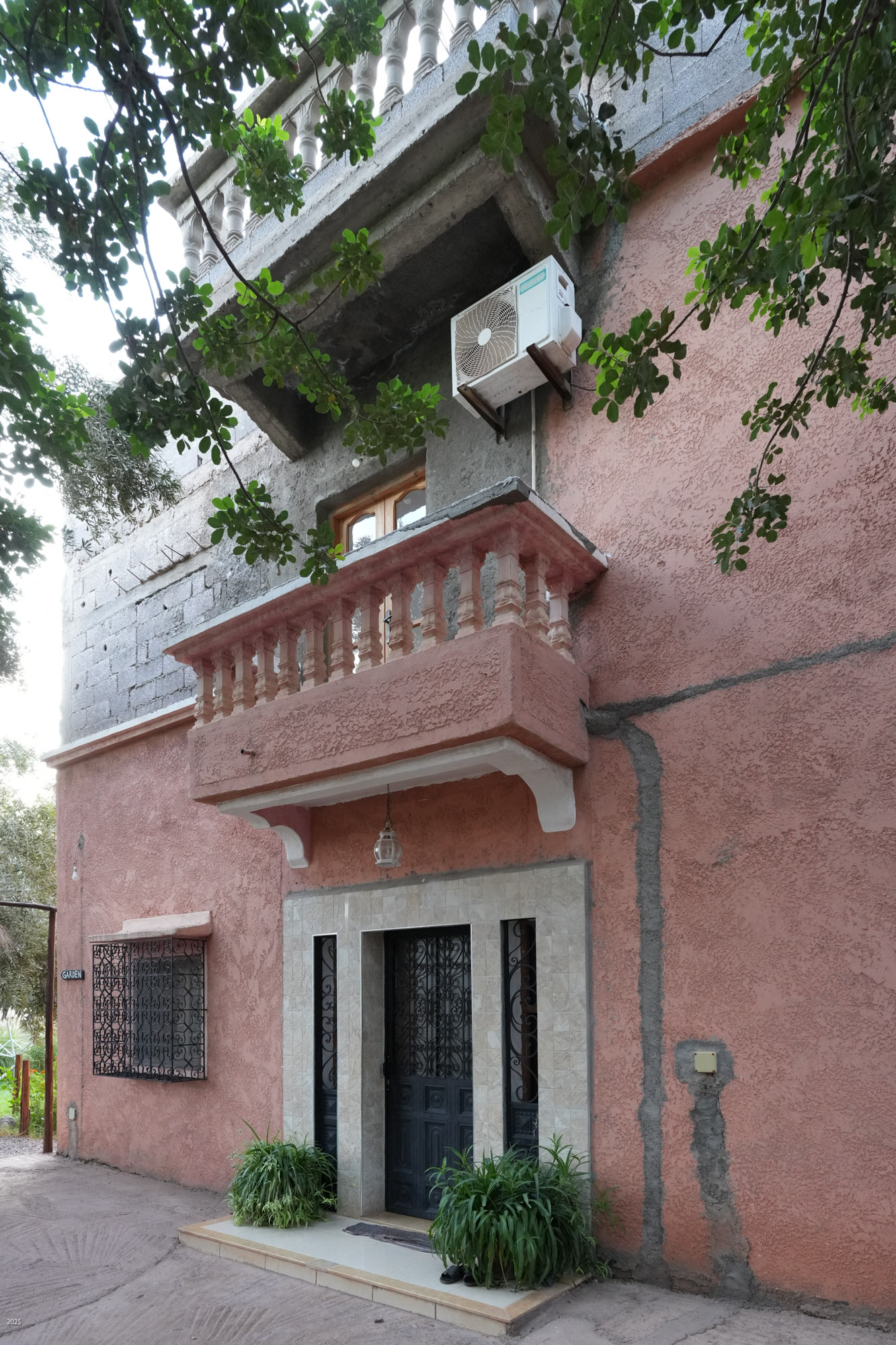
Riad Idar is a small guest house with just two bedrooms and a large common room upstairs. The family lives downstairs. Located just a block off the highway in an olive grove, it was a lovely, peaceful place to stay. Our host was very informative about trails and looked after our every need, while his wife and mother provided us with delicious meals. A nearby cock was the only thing to disturb the tranquility. At the end of October, with daylight savings time, the sun rose over the mountains to the east only after eight, but the cock arose much earlier and crowed vociferously at regular intervals throughout the day.

Ouirgane
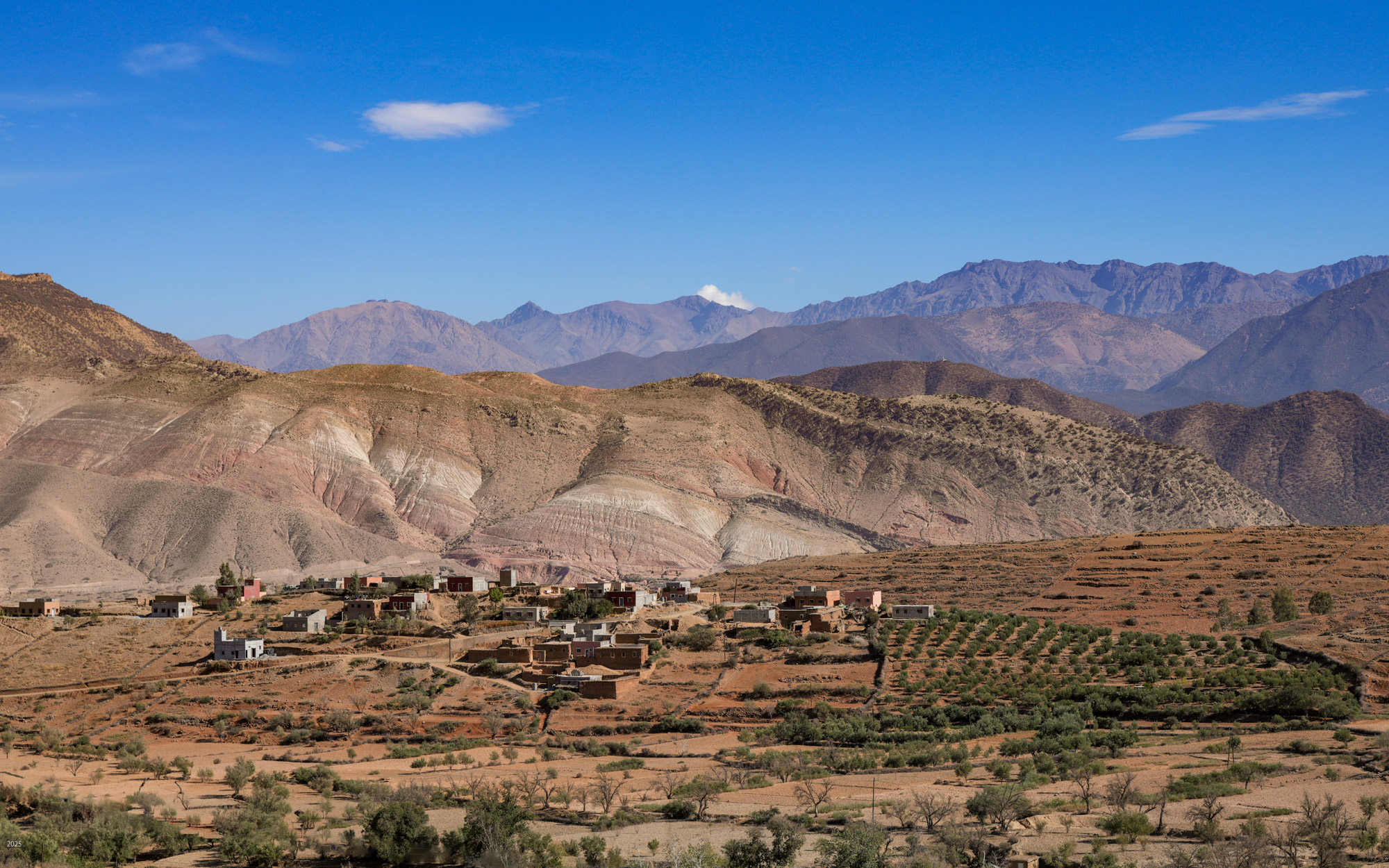
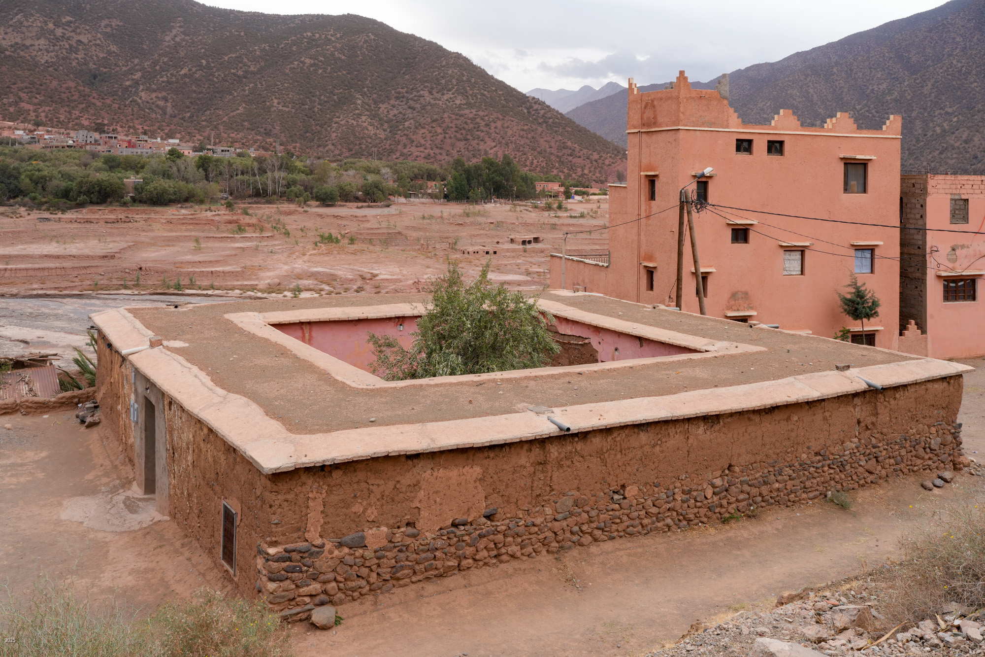
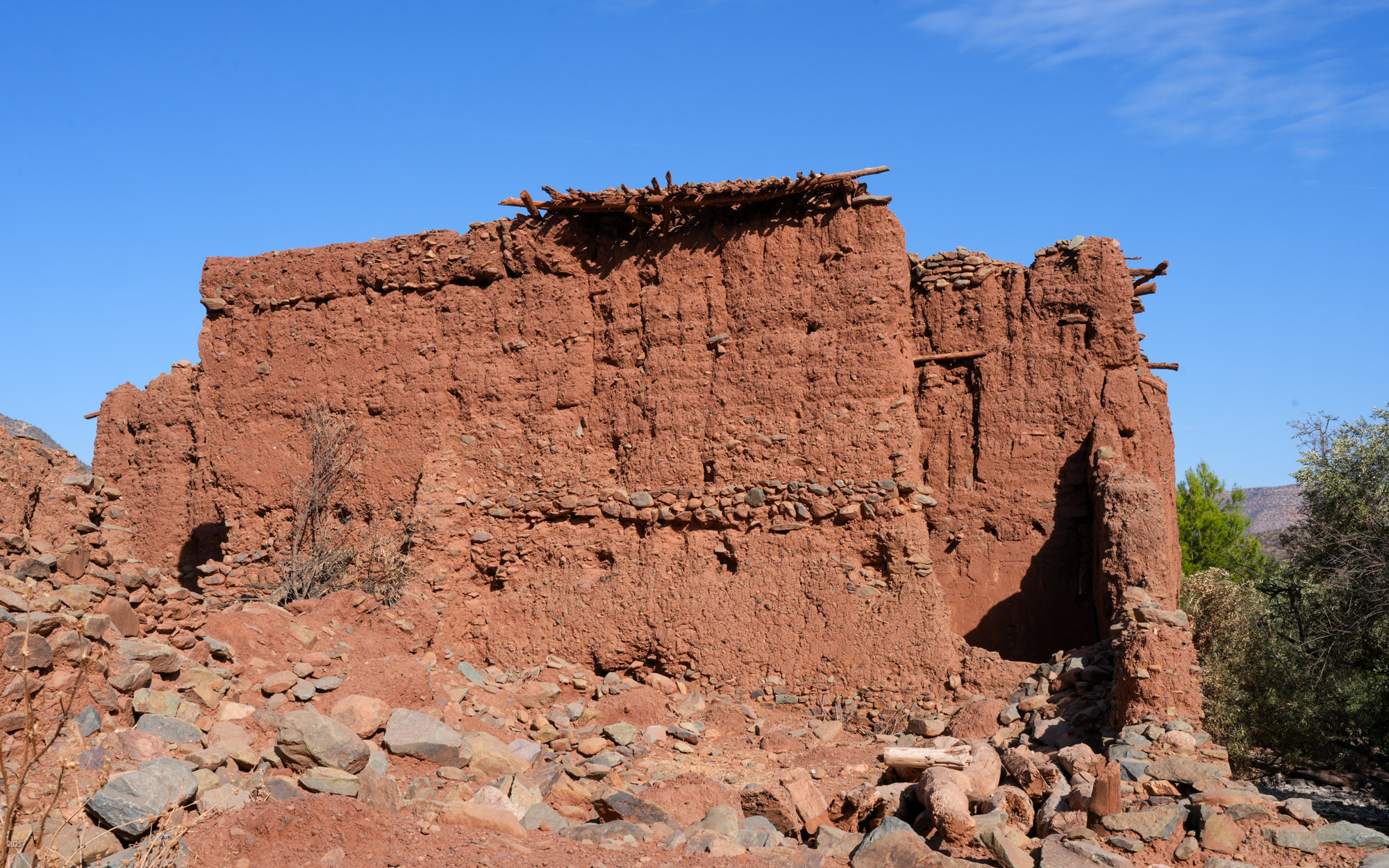
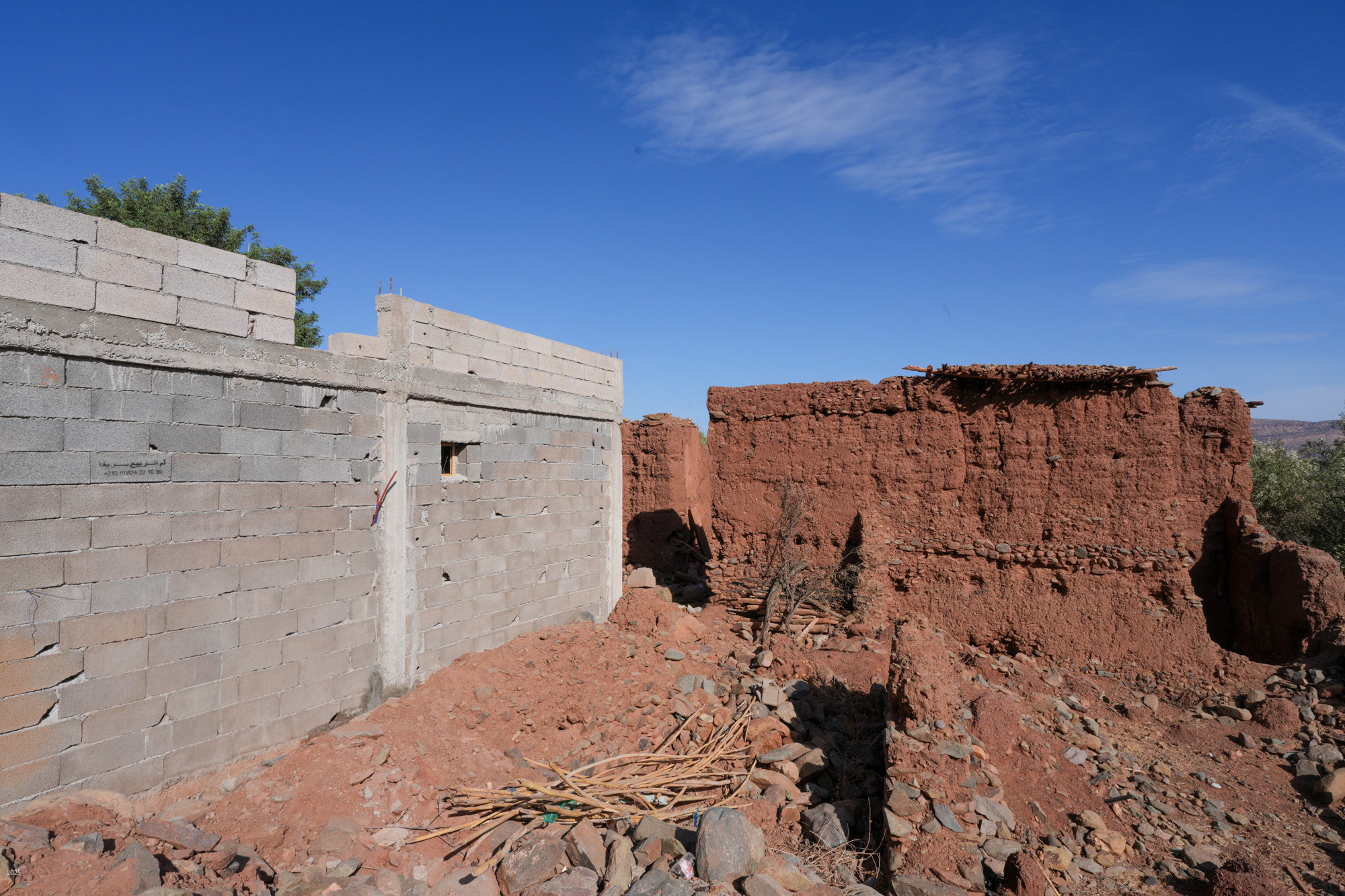
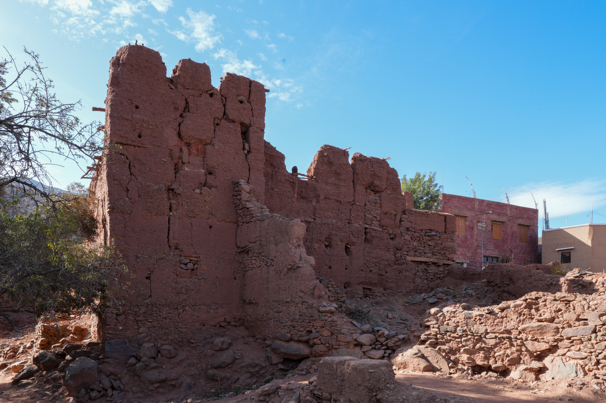
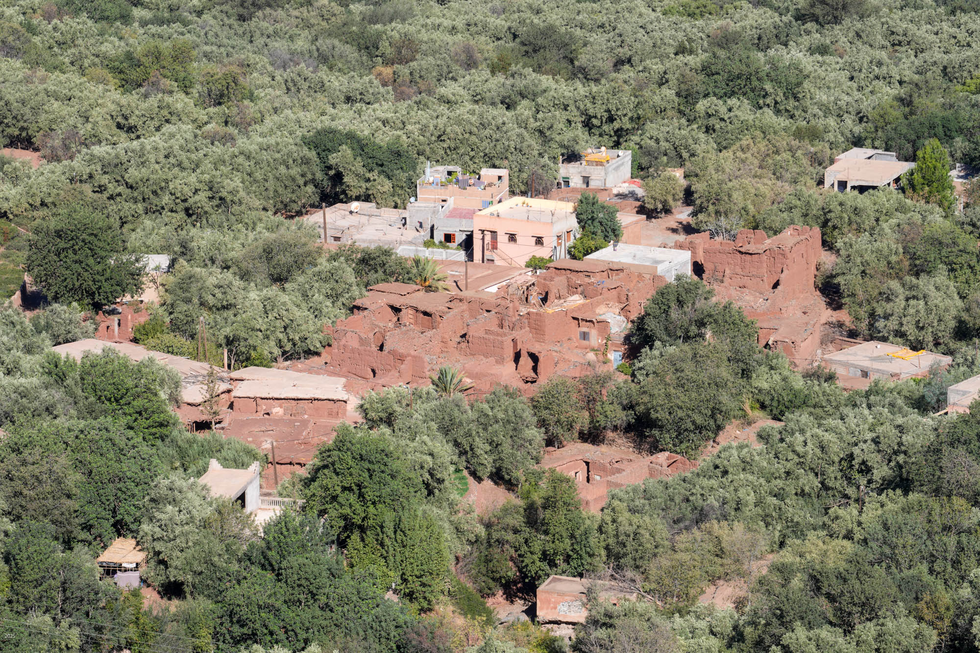
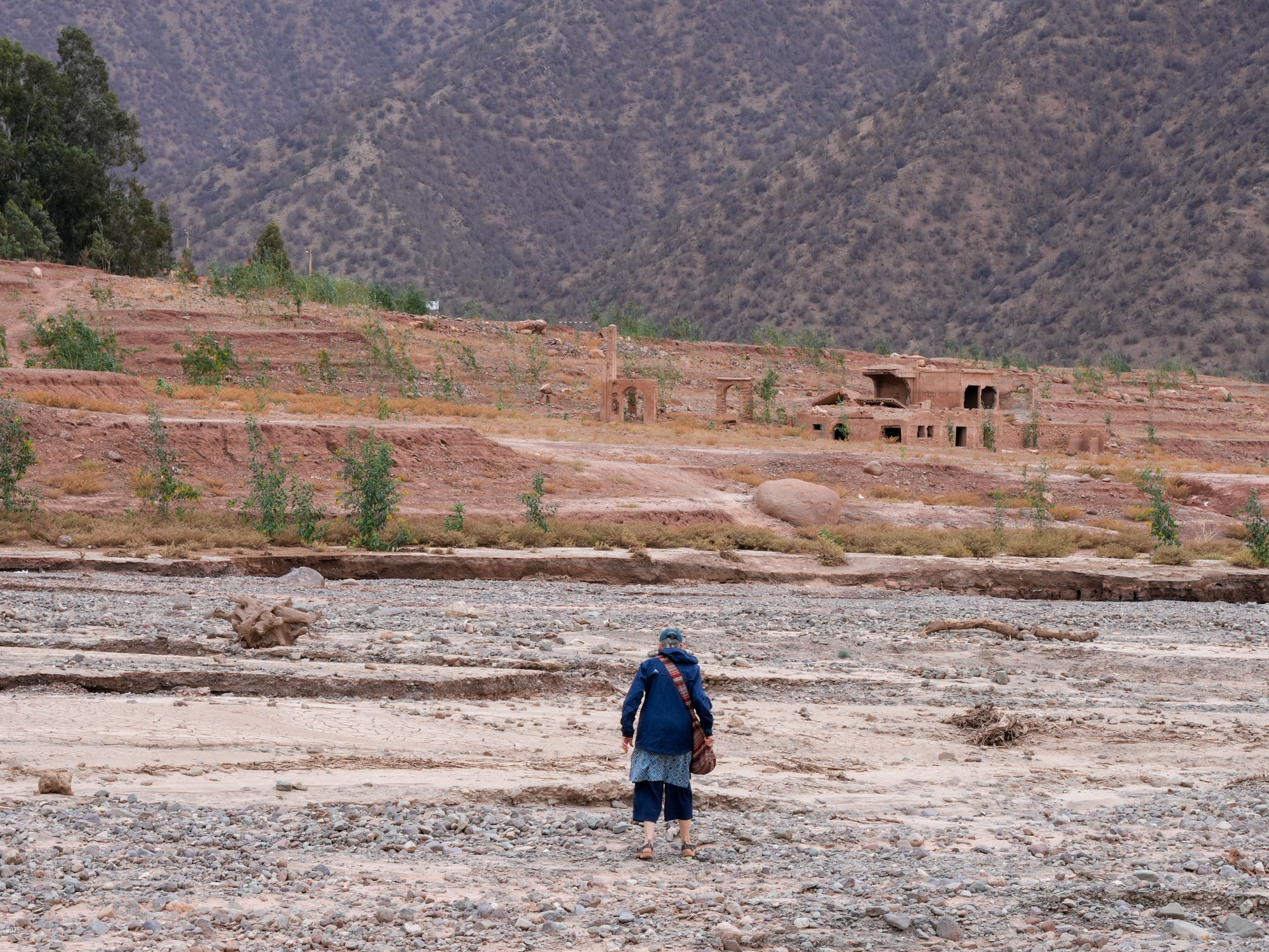
The income from foreign tourists and Marrakesh visitors is very important for the town as it has suffered seven years of drought and was hit by an earthquake in September 2023. Almost 3,000 people died in the earthquake. As the total population of the town before the quake was about 7,000, the quake was devastating. Many buildings were destroyed. In exploring the area we found remnants of tent and prefab building camps and many buildings still lying in ruins. We also found a lot of construction, as families still work to repair the damage. Most of the construction now seems to be done within the family, with fathers and sons working together. Many families are also renovating or building to offer night stays to visitors.
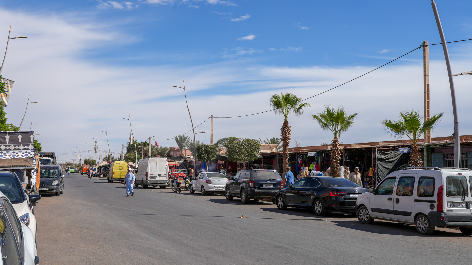
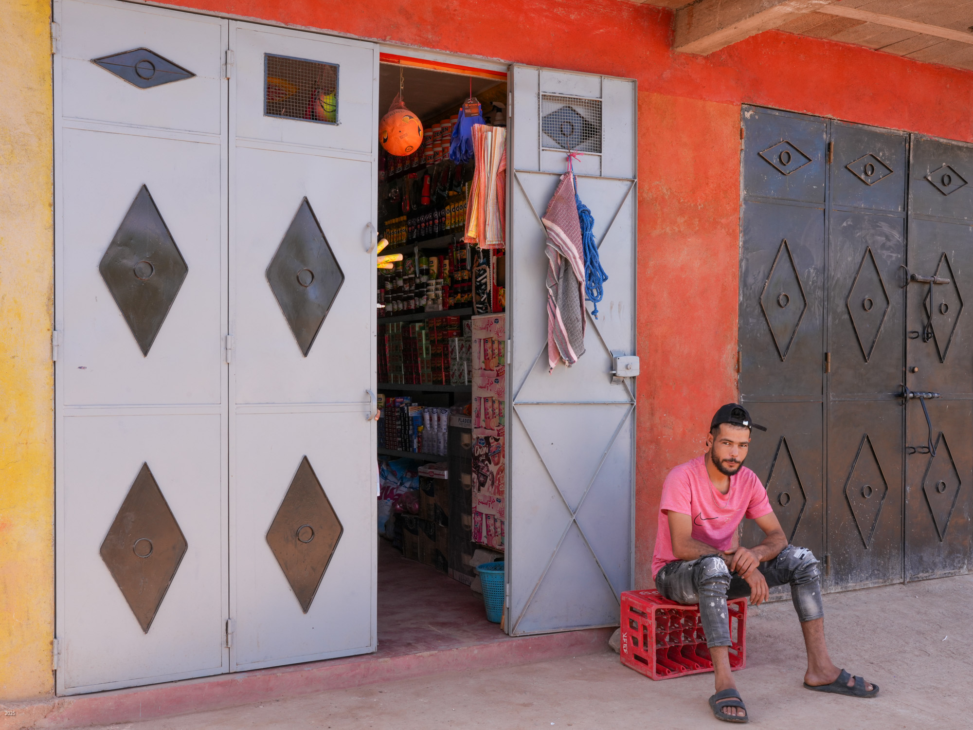
The town of Ouirgane lies along the highway which is dotted with public buildings and shops for locals and tourists, as well as several restaurants, cafés and tea houses. The shops are very small and offer only a small selection of items. For other shopping the locals go to Asni, 17 km away.
We spent our days wandering through the town’s alleyways, exploring the paths through olive groves and villages before climbing into the mountains behind the town or wandering over to the reservoir and dam. As is often the case in the mountains, foot paths are often much more direct and quicker than roads. There were many footpaths that were well used and maintained.
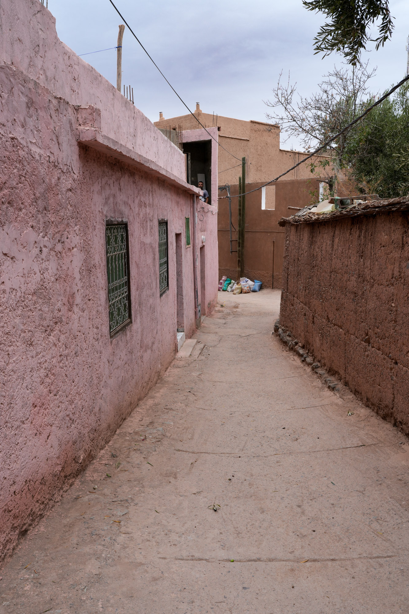
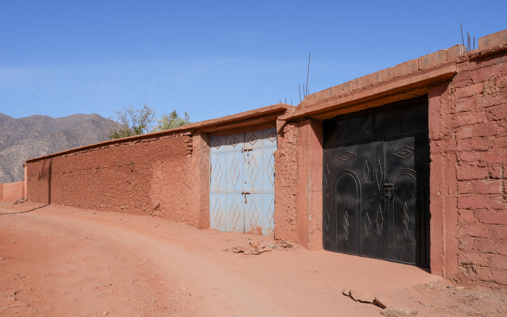
One block away from the highway you enter a labyrinth of alleyways with houses on both sides behind walls. Some alleys are wide enough for a car for a short distance, many accommodate only pedestrians and two wheelers.

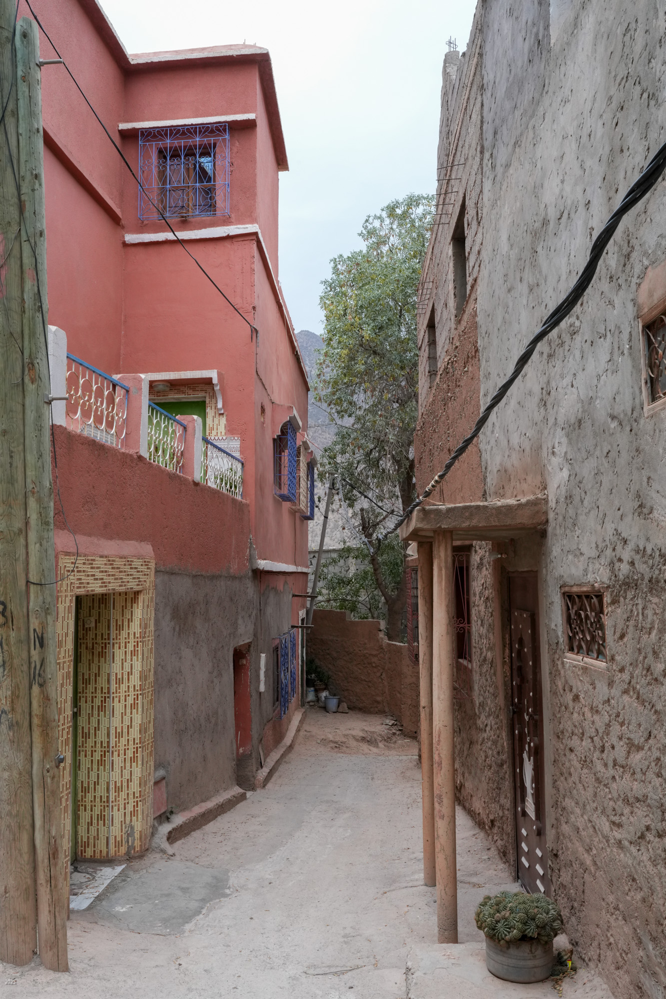
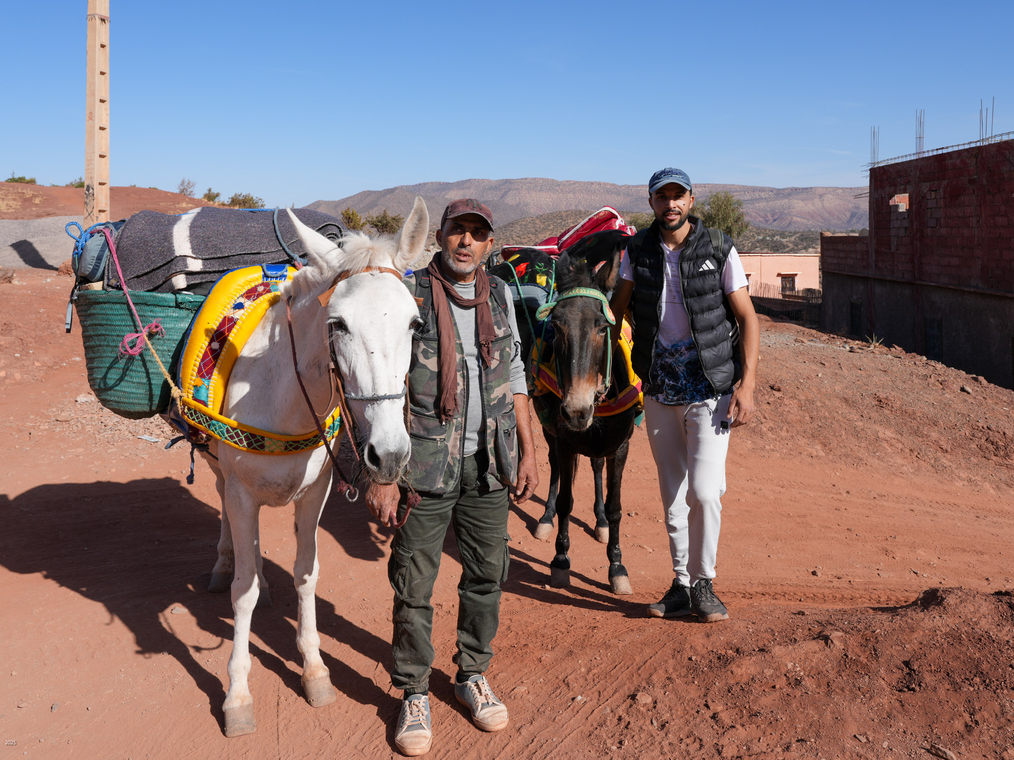
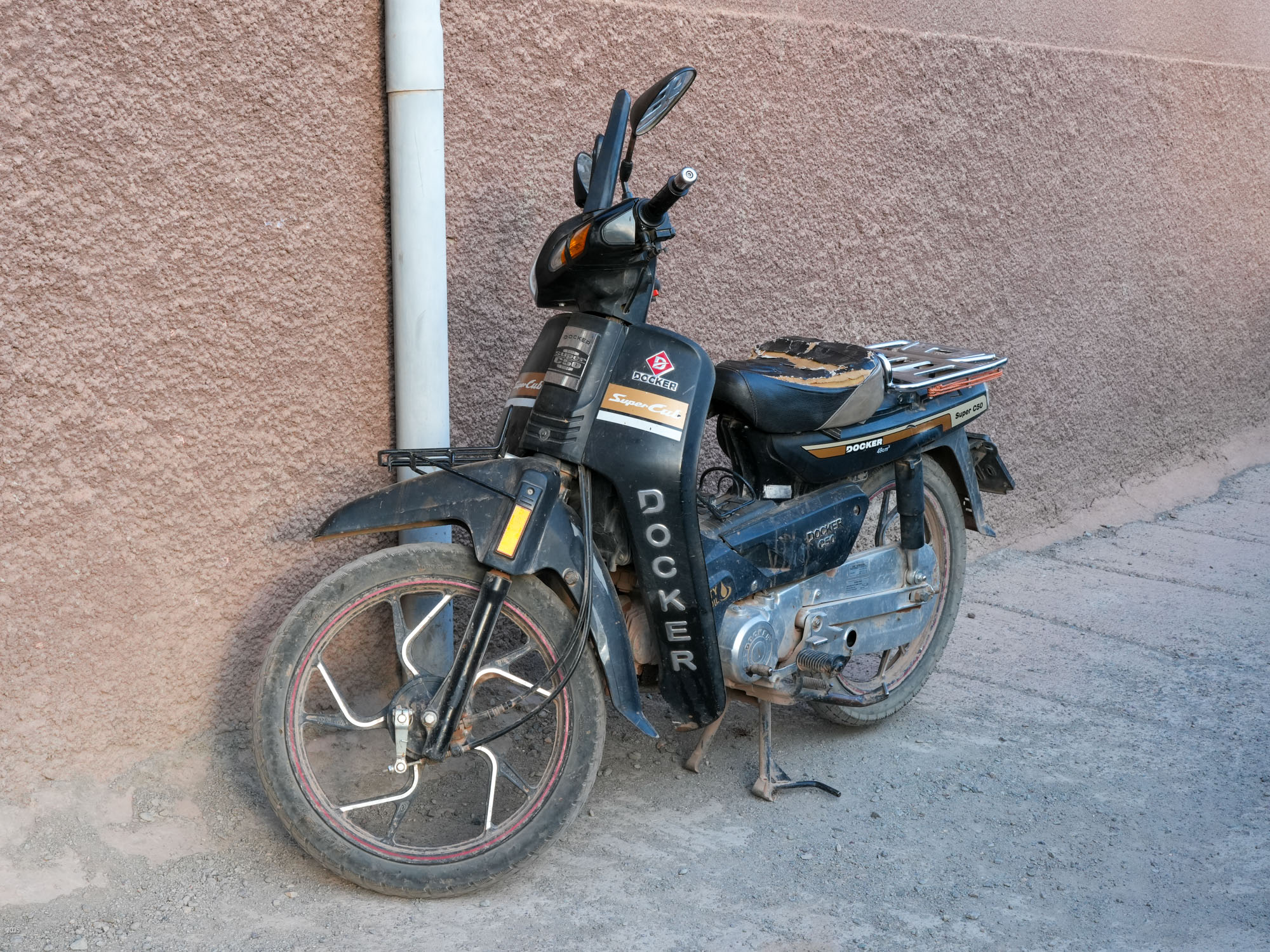
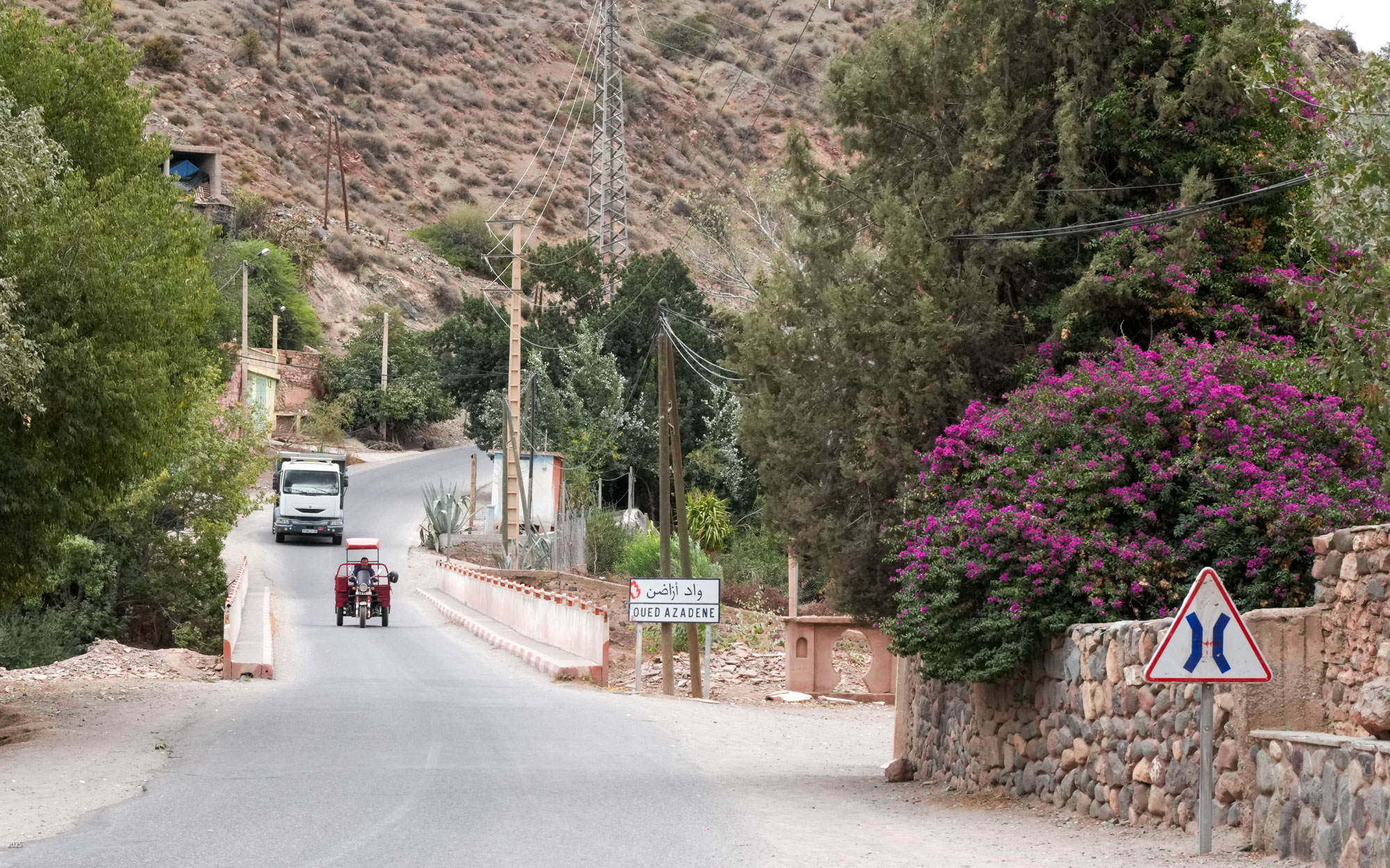
Motor vehicles are few. Locals speed along on Docker motor bikes sans helmets. Docker 3-wheelers are used for goods transport. Some tradesmen have vans, though donkeys are still used for transport. A few public and private vans form the public transit system.
The hills above Ouirgane
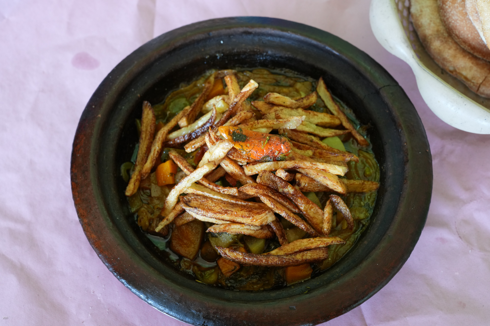
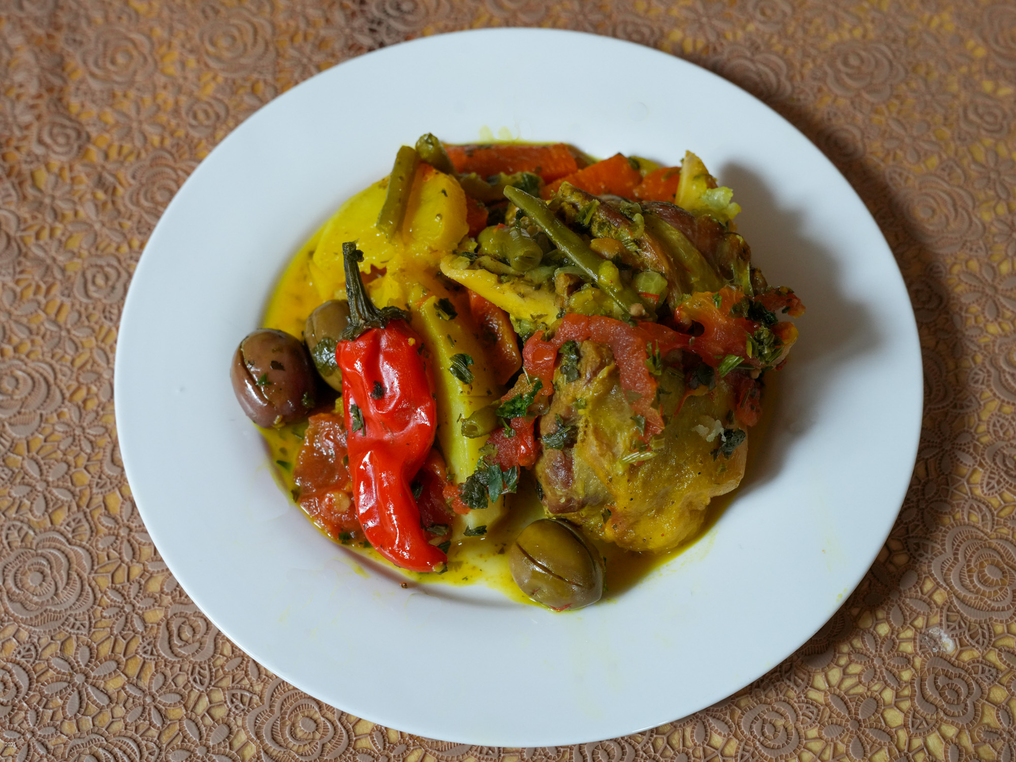
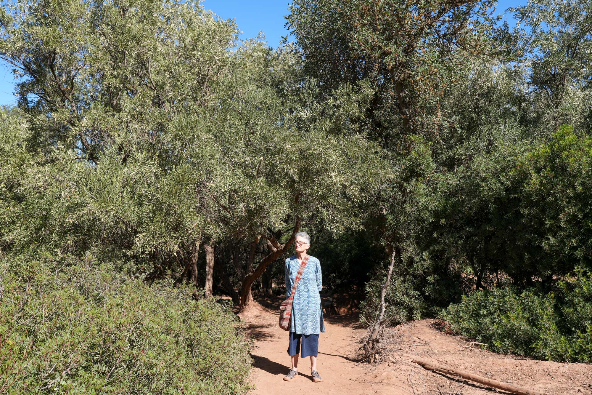
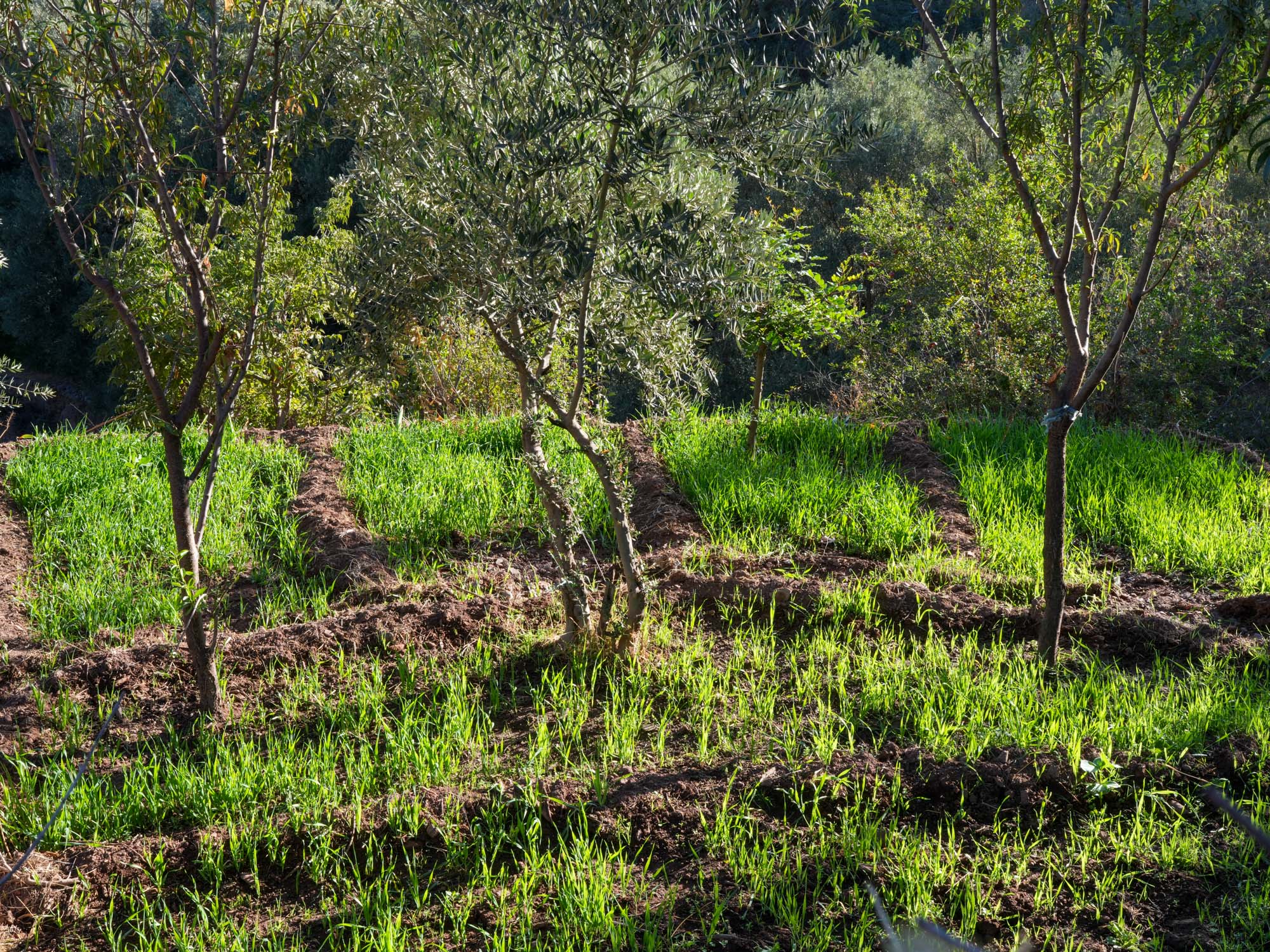
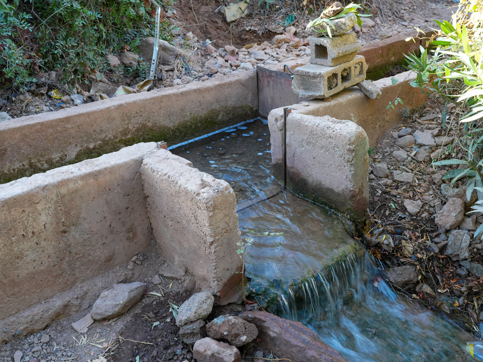
Behind the alleyways the paths climb past olive groves bordered by communal irrigation channels. Near Agouni we saw a few small patches of wheat. Our host said that because of the drought they had had several years of poor harvests, but 2024 had been better. The olives and olive oil are delicious. We had olives every morning with our breakfast of msemen (a sweet paratha), bread, omelette, cheese and honey. The area also usually produces good honey, but because of the drought and the paucity of flowers, the bees are now being fed sugar. Tajine with bread and salad is the standard lunch. As we prefer a light dinner we settled on bread with the lovely olive oil, yogurt and fruit for dinner.


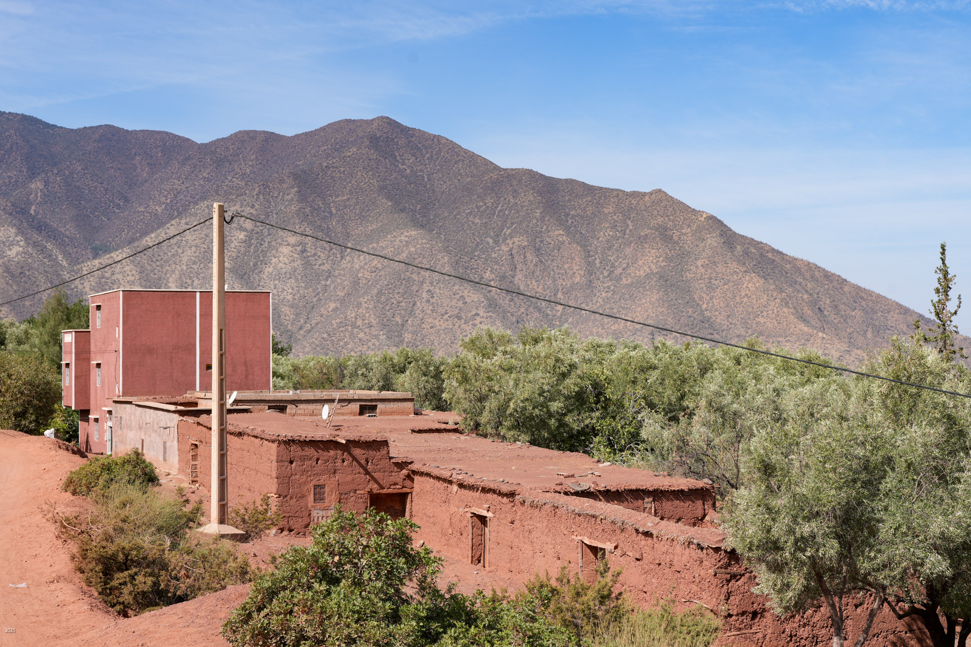
The houses were built with stone and mud from the mountains on which they stood. Many of them were quite large, most probably for joint families. There were few windows facing the street to maintain the privacy of the women within. But women went about outside quite a bit. They generally wore long dresses covered with a coat and hijab or a shawl. In the heat of midday some women added a broad brimmed hat. There were usually separate sheds for livestock - cows, donkeys, beautiful horses, goats, sheep, chickens, ducks. Cats were ubiquitous here as everywhere in Morocco, and some houses had guard dogs.
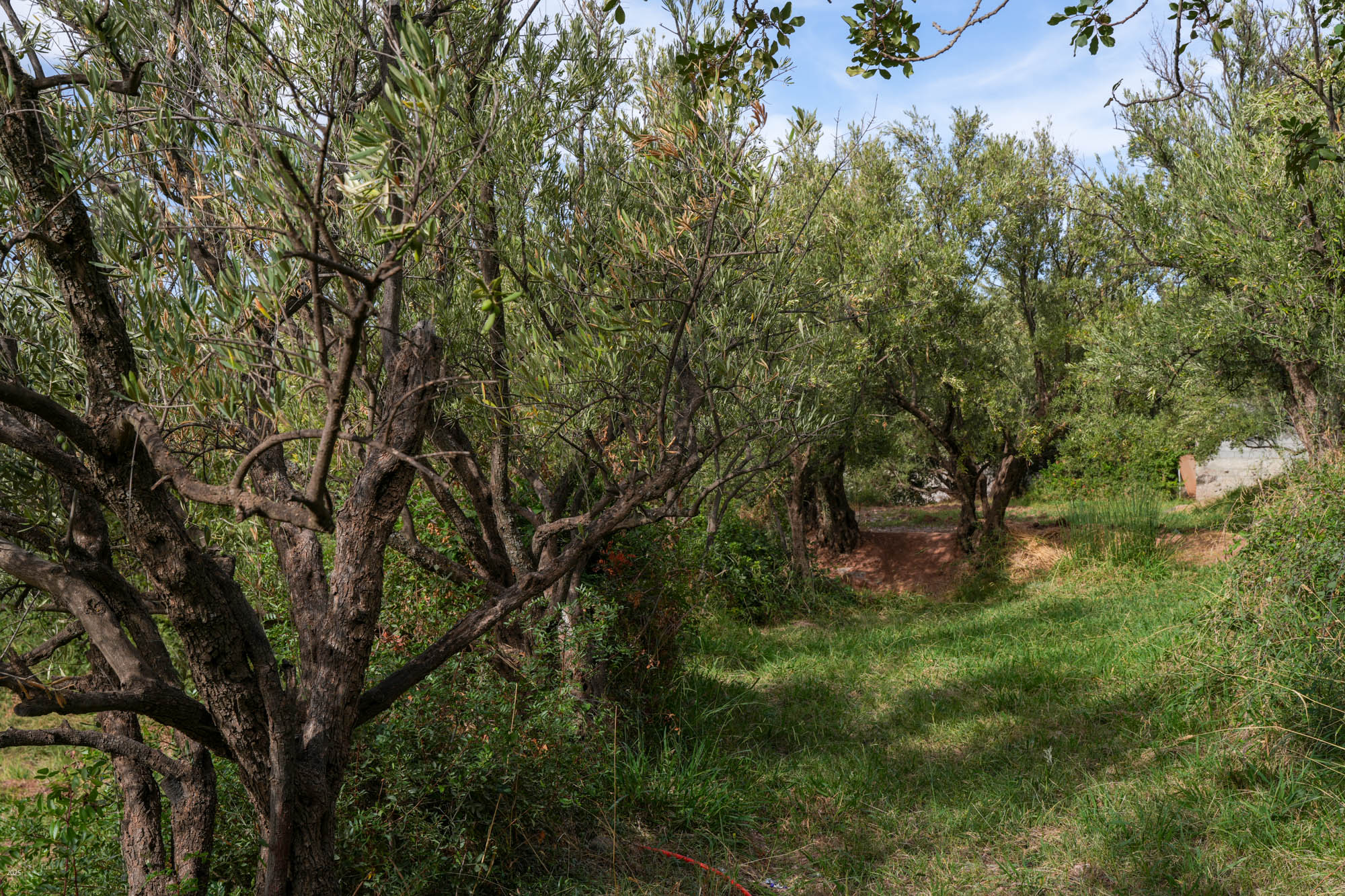
Walking through olive groves above Riad Idar for ~1 km, we came upon the Berber village of Agouni. Most of the old houses were destroyed in the 2023 earthquake. The village has many modern houses, similar in form to the old ones, but built with concrete structures and walls of hollow blocks.
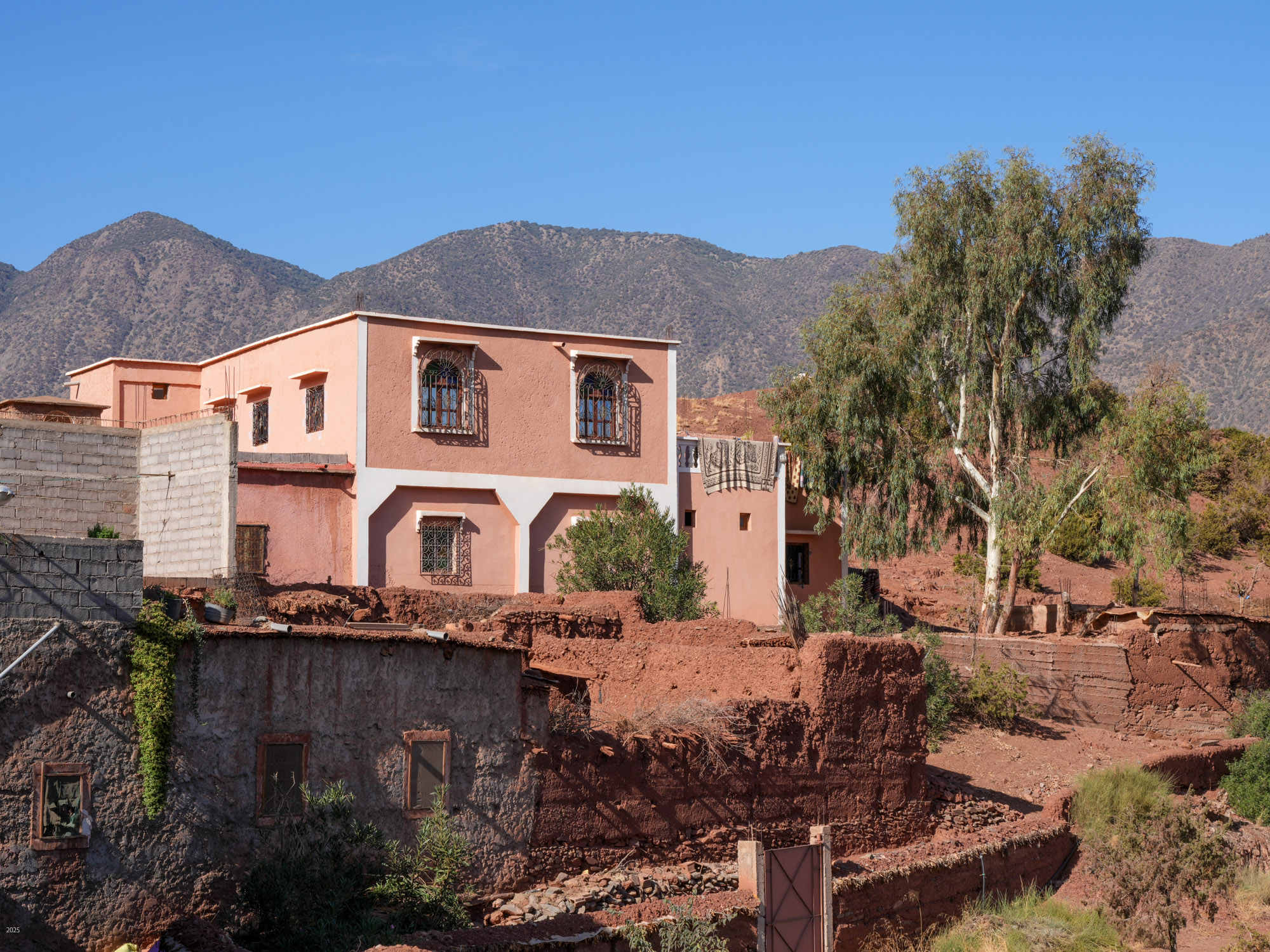

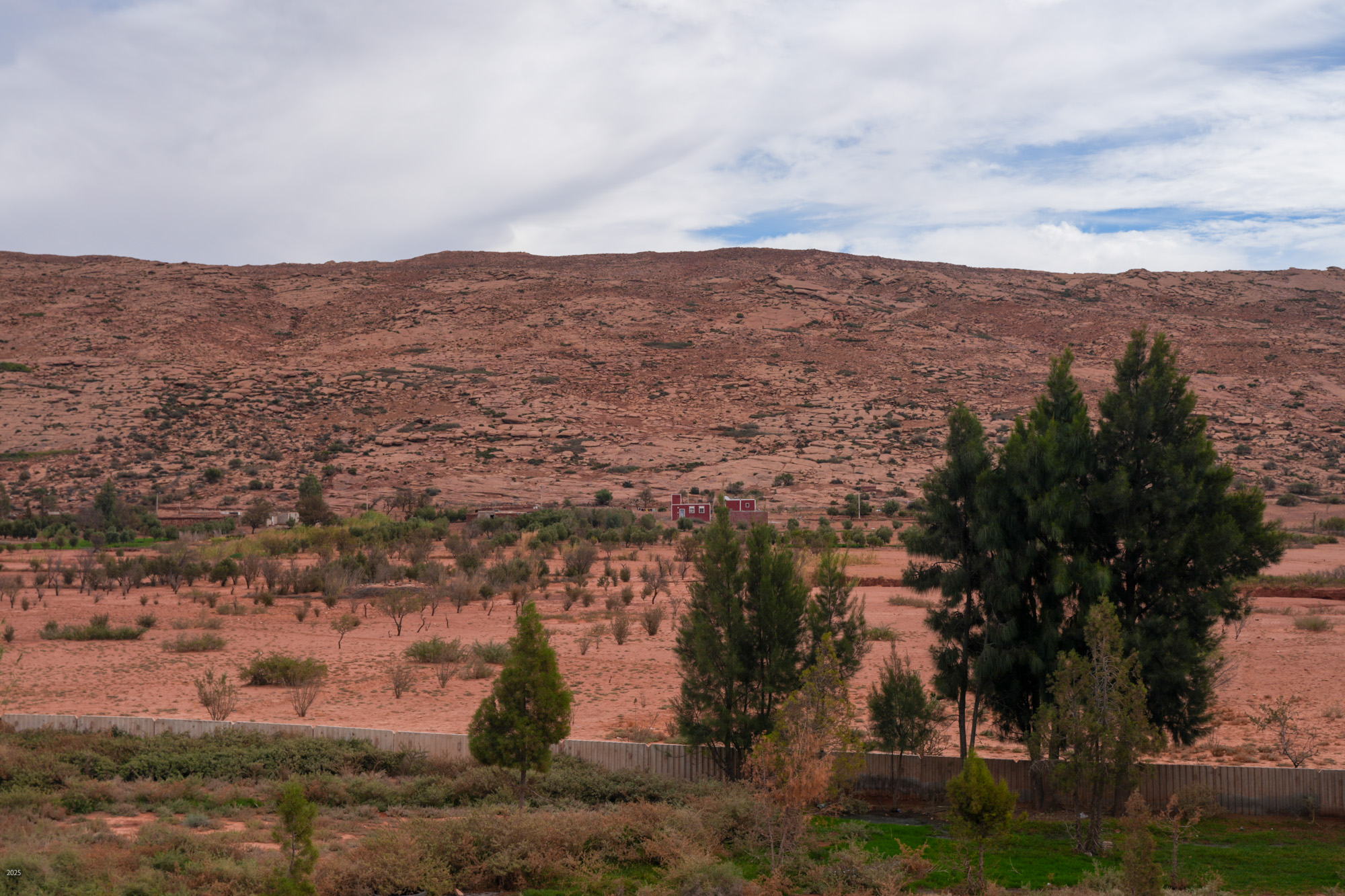
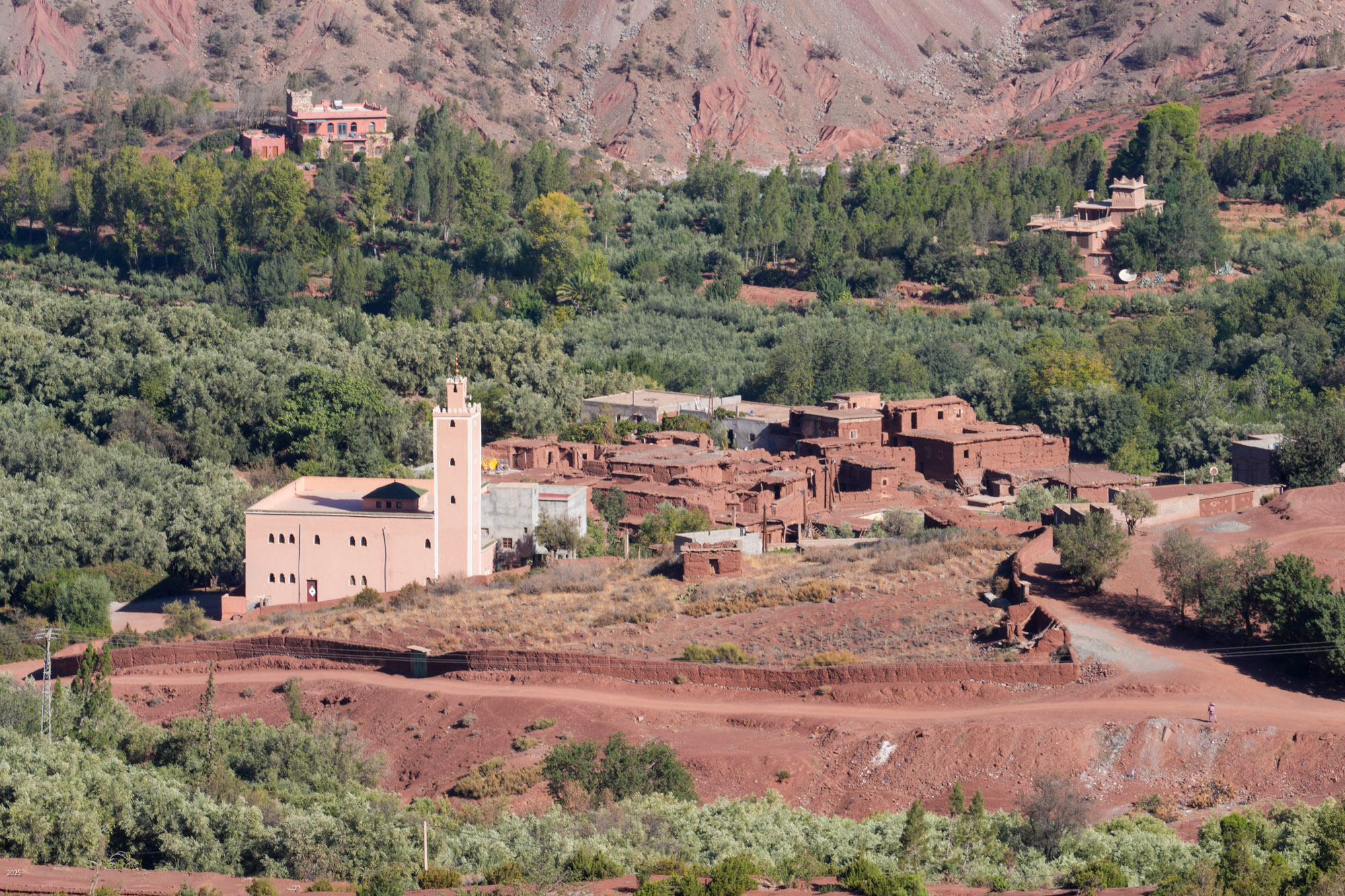
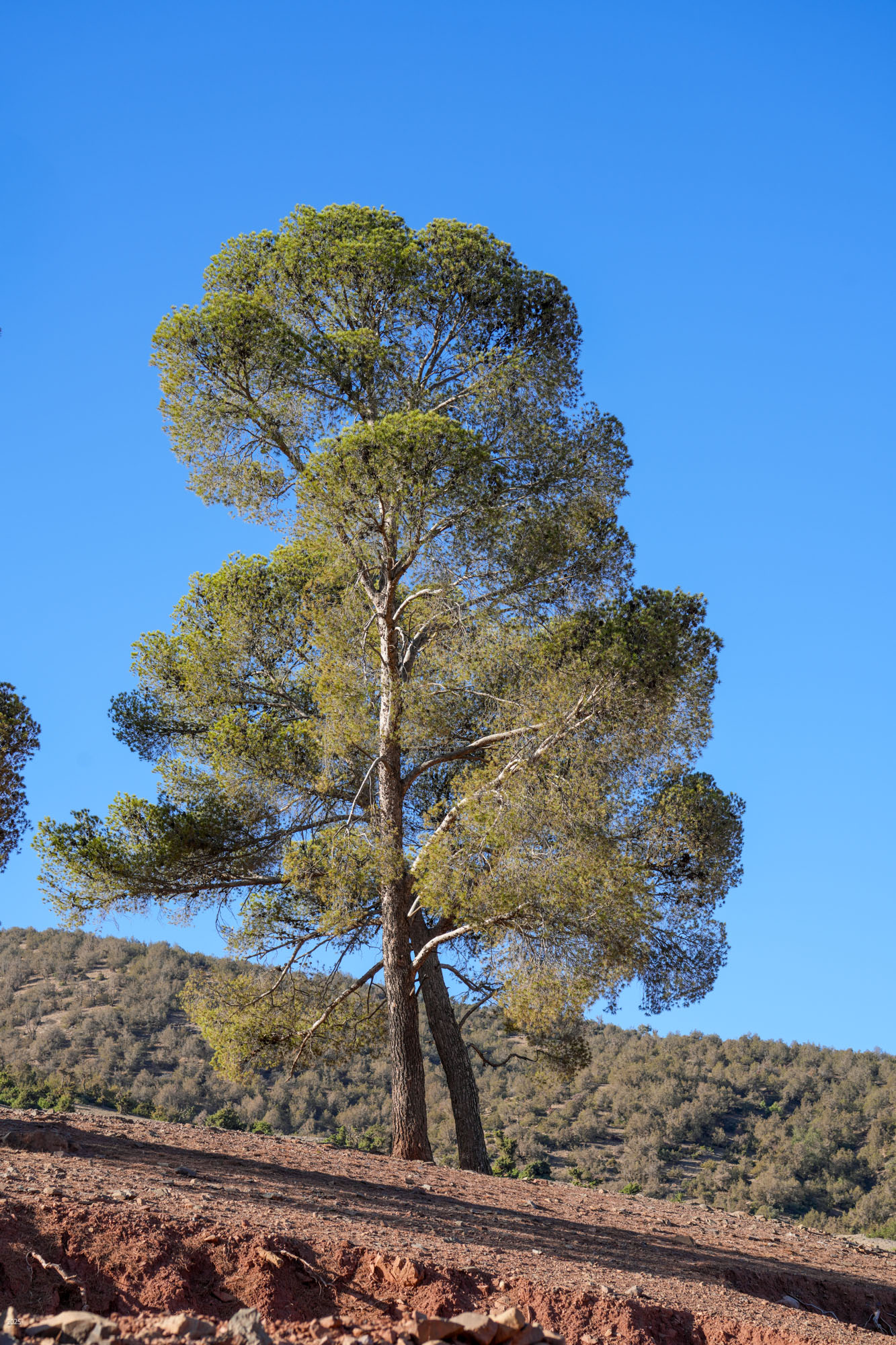
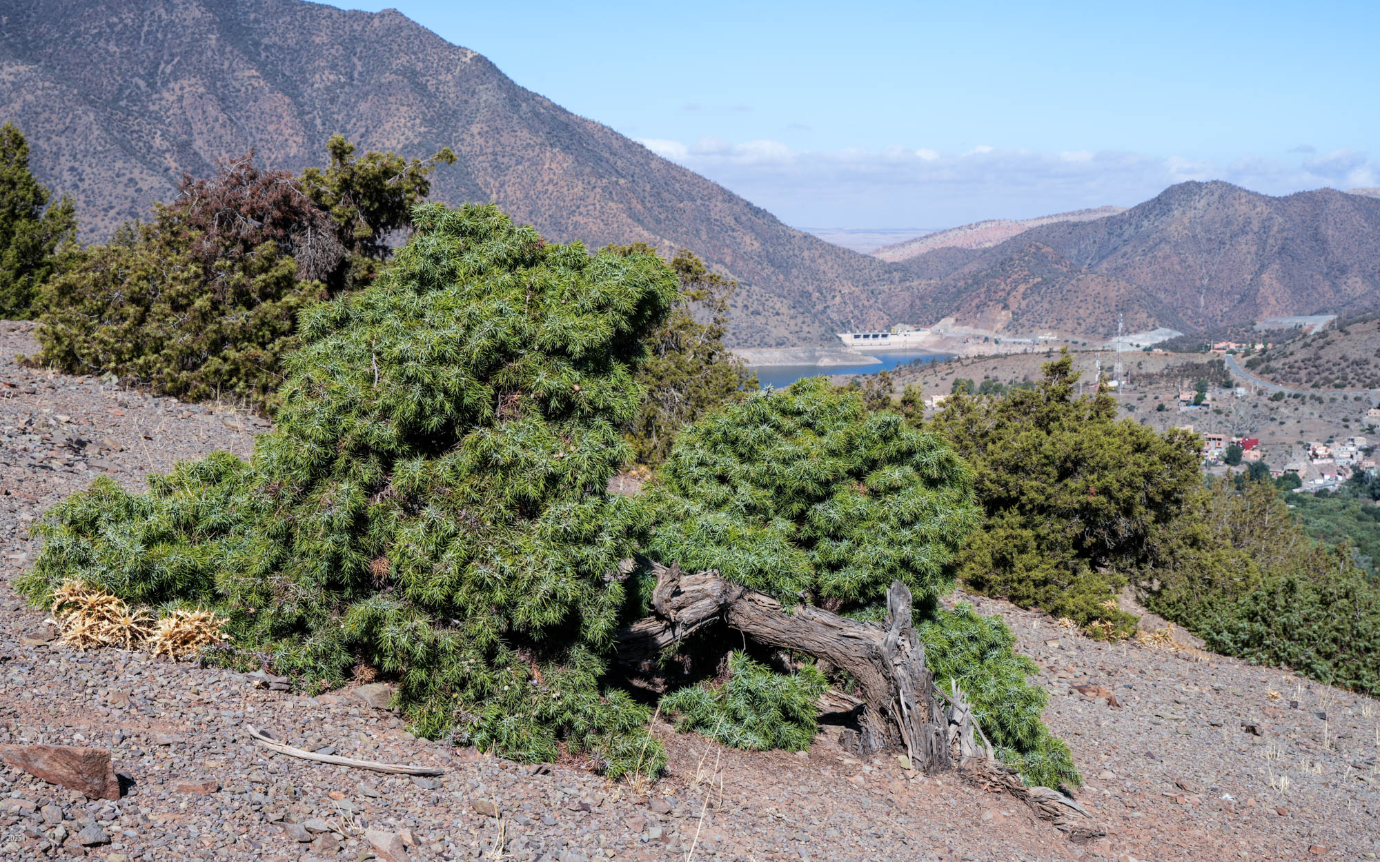
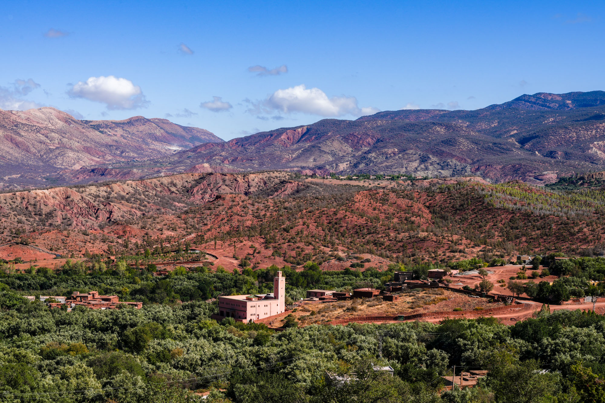
Above Agouni, we took a dirt road to the left to reach Anraz village after ~1 km. Anraz has a prominent mosque set amidst old and new buildings. The village is surrounded by olive groves. We climbed the road above Anraz to reach a prominence about 600' above Ouirgane. We had a snack while savouring the panoramic views. Below us were Agouni and Ouirgane, the reservoir and dam with a steep hill on the far side of the reservoir. To the left, the Anraz mosque stood out against the ridge rising up to the high range behind us. Olive groves carpeted the valleys and lower slopes. The upper slopes were sparsely forested with a few pines, stunted juniper and other shrubs. The vistas were a mix of browns, vivid reds, green and purple, under a blue sky, accentuated by unusual showers the previous night.
The Berbers
Priscilla was trying to practise her French as we were soon to meet with our daughter’s in-laws who speak only or mainly French. However, the Berbers are proud of their independence and did not wish to speak French, but preferred English. This no doubt improved our ability to communicate easily. They were also very welcoming and happy to guide us when we wanted to check directions. When we were tired and faced with a hike of several km in the hot sun to reach Riad Idar for lunch, a villager from Agouni readily gave us a ride in his car.
Berber is a name given by the Romans to anyone who didn’t speak Latin. Today, the term covers many tribes in Morocco and other parts of North Africa. Some tribes have their own names, some people prefer the name Amizagh instead of Berber. All the people who spoke with us identified themselves as Berber.
Yacoub el Mansour Dam
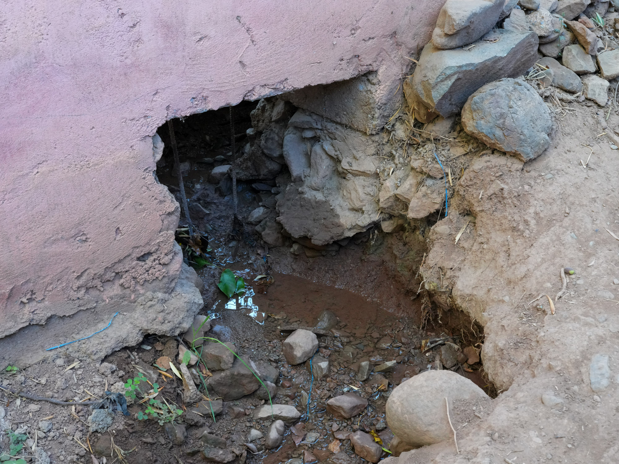
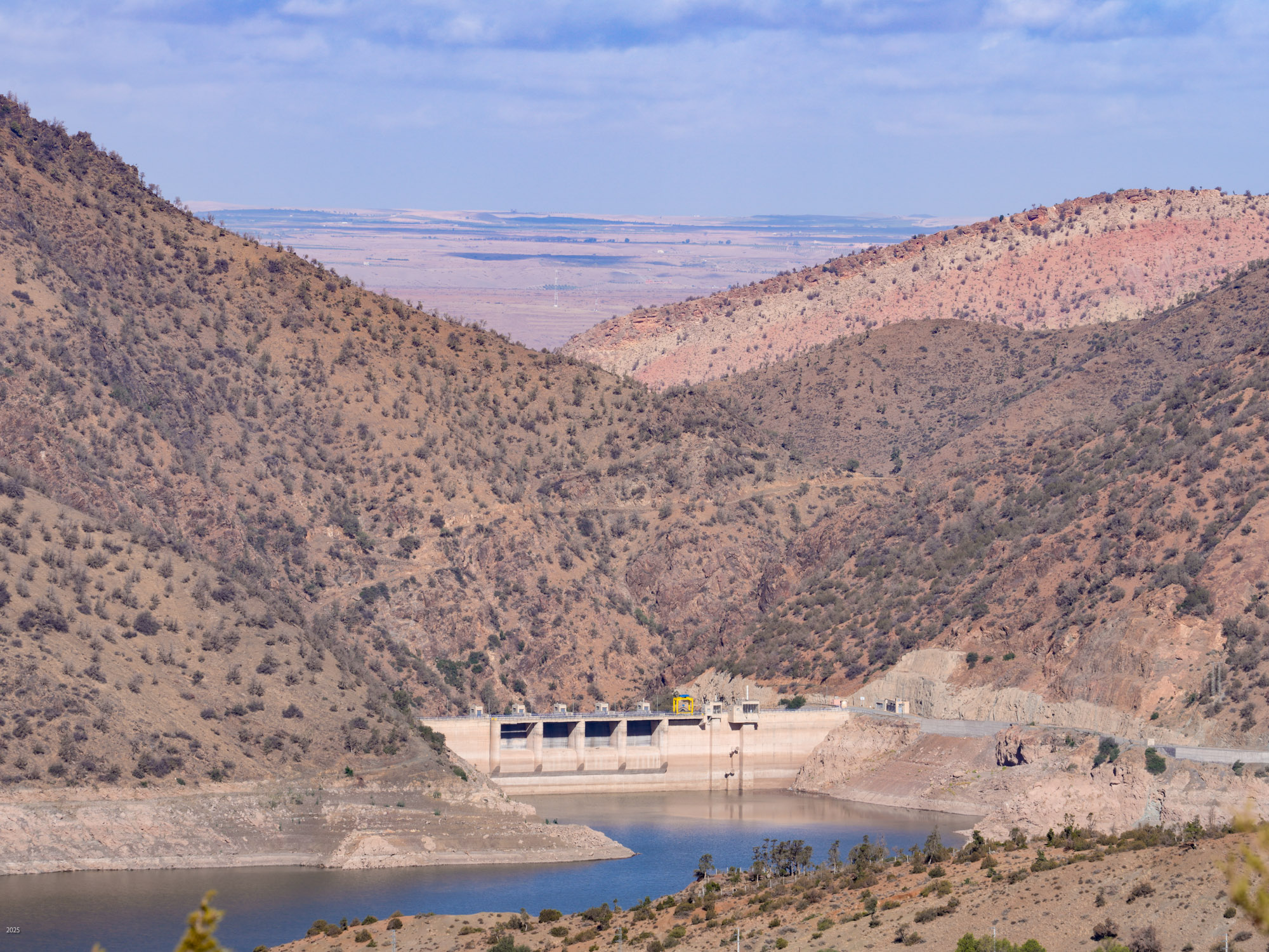
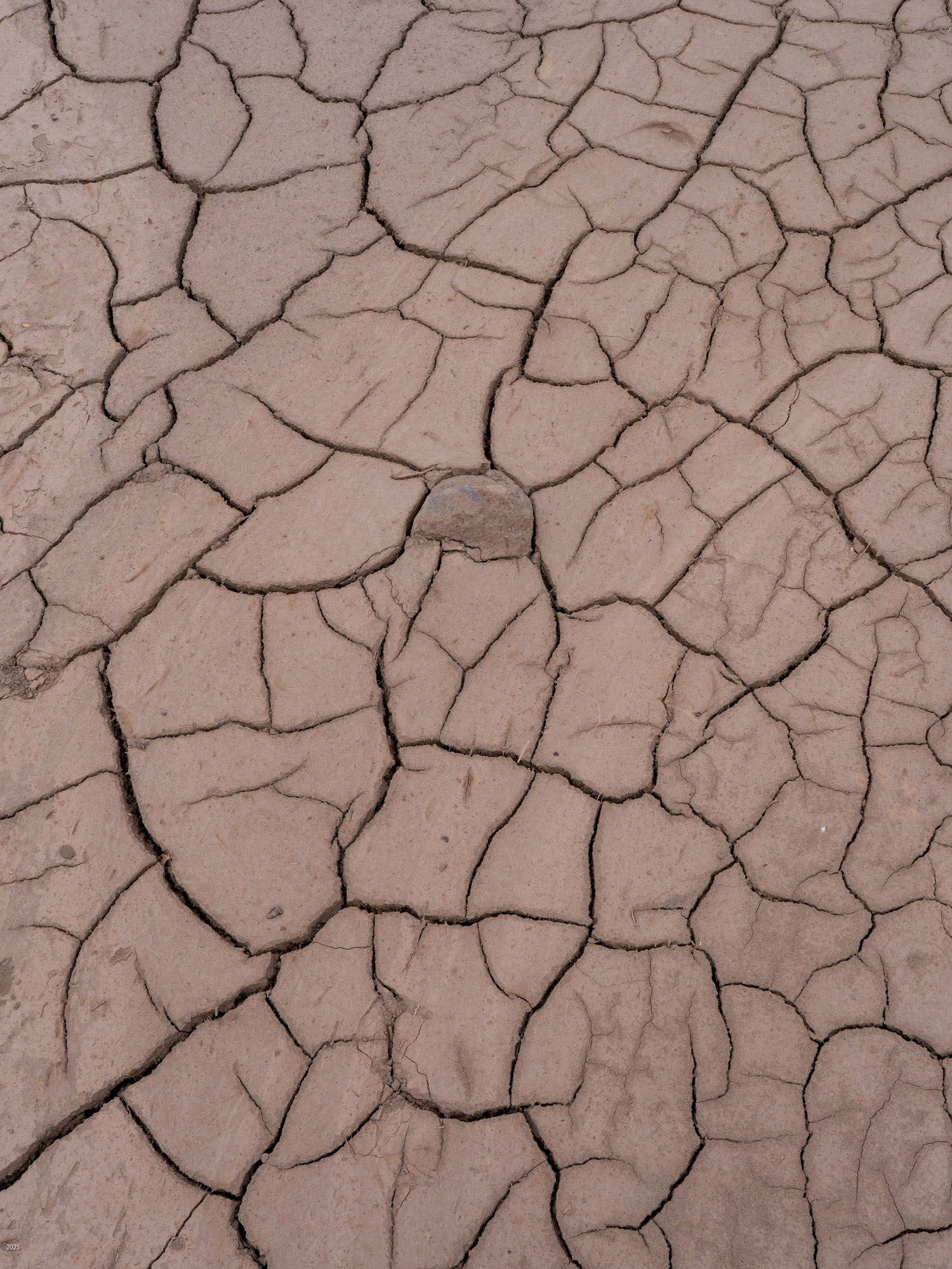
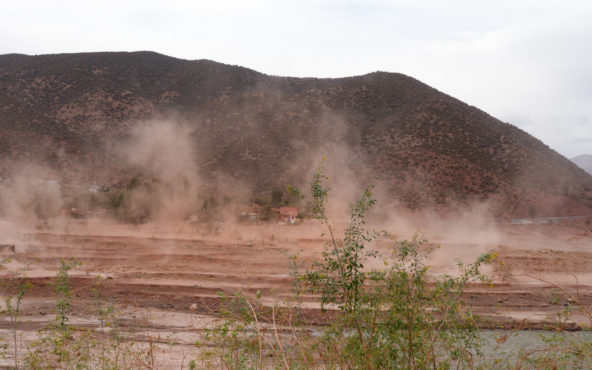
The N'fis river flows along the west edge of Ouirgane. When it emerges from the mountains into the plains, it feeds the Takerkoust Reservoir. This was built in 1935 to serve the water needs of Marrakech and the surrounding fertile plains. Over the years, the Takerkoust Reservoir was getting silted up. To control the influx of silt, in 2008 the Yacoub el Mansour Dam was built near Ouirgane. Also called the Ouirgane Dam, the resulting reservoir forms a scenic backdrop for the town. It provides some recreation with fishing, boating and hiking trails along its banks. Due to the 7 years of drought, the reservoir is far below its maximum level. Expanses of red mud are exposed and winds whip up clouds of dust.
Closing
With few vehicles, people on foot and donkeys carrying loads, there was often a feel of life in earlier centuries. If you delve into the history of the region, you will read that the Berbers retreated to the mountains to escape the various invading armies - Phoenician, Roman, Byzantine, Arab and French. Most of these invaders concentrated on the more arable land near the coast and contented themselves with extracting agricultural produce and taxes. The Berbers continued with little interference until the French set about subduing them in the 20th century. It is easy to picture the Berbers quietly continuing their lives in the hidden valley of Ouirgane.
The images in this essay were taken by Timothy A Gonsalves. Click on any image to view a larger version. Right-click to save the image. If you want high-resolution images for printing, send a request by email. Some of my images from this trip are available for free download at Wikimedia Commons.
Wikipedia has articles on Ouirgane, the Ouirgane Dam, the 2023 earthquake and the Western High Atlas.
Typeset using OpenOffice
Converted to responsive HTML using blog_parser by M. Praveen Kumar and N. Jayaprakash